Meteorologists have warned that a rare “monster” El Niño will strike this summer, potentially becoming one of the most powerful such events since record-keeping began in the 1870s.
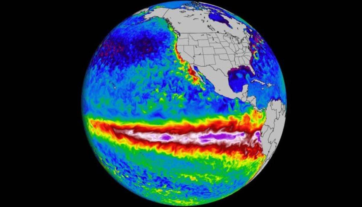
El Niño is a natural climate phenomenon that occurs when there is an increase in sea surface temperature in the tropical Pacific Ocean, recurring every two to seven years.
It is caused by the disruption of the usual air flow and transport of warm water to the coasts of South America.
This usually happens when warm waters from the western Pacific move toward South America. As a result of this change, cold, nutrient-rich water from upwelling near Peru causes an increase in atmospheric temperature, which ultimately alters atmospheric circulation and global weather patterns.
Data from the European Center for Medium-Range Weather Forecasts (ECMWF) predicts that there is now a 100% chance of a super El Niño forming by November.
Sea surface temperatures are expected to rise in the eastern Pacific to nearly 3 degrees Celsius above average.
This threshold is the highest ever recorded. The planet has not experienced an El Niño of this magnitude since 1877-78.
What this means for the weather
This super El Niño can trigger significant global weather disruptions.
In New England, record summer heat is expected, as well as more heat waves, higher humidity levels and above-normal precipitation, due to heavy rains from coastal storms.
During a typical El Niño period, hurricane formation in the Atlantic basin is limited by strong wind shear, while storms increase in the eastern Pacific basin.
Winter conditions in the south may be wetter and snowier than average, while in the north winter conditions may be milder and less humid.
Global consequences
These weather disruptions can cause food shortages, water supply disruptions and even civil conflicts in vulnerable tropical countries.
New heatwave records are about to be set as the biggest El Niño is about to strike.